Project partners are:
Province of Latina

The Pontine territory is composed of 33 municipalities, it has a population of 535,943 inhabitants (source ISTAT 2007) and covers 2,250 square kilometres: from the Agro Pontino to Garigliano and from the Lepini, Ausoni and Aurunci Mountains to the Tyrrhenian coast. It comprises also the isles of Ponza, Ventotene and Santo Stefano. It encompasses very different social and human realities, historically divided between the Bourbon influence in the South and the Papal State in the North.
go to website | up
Municipality of Latina
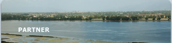
 Latina is placed in the heart of the Agro Pontino, in a mostly plain area. The city is a few kilometres away from the Tyrrhenian Sea and the Lepini Mountains. Latina is placed in the heart of the Agro Pontino, in a mostly plain area. The city is a few kilometres away from the Tyrrhenian Sea and the Lepini Mountains.
Its territory, among the most extensive in the Region of Latium, comprises also many “foundation towns”, established during the land reclamation of the Thirties. Part of its territory is among the protected areas of the Circeo National Park.
go to website | up
Circeo National Park
 Placed along the Tyrrhenian coast of southern Latium, about 100 kilometres South of Rome, between Anzio and Terracina, the Circeo National Park covers about 8,500 hectares, all in the Province of Latina and in particular in the municipalities of Latina, Sabaudia, San Felice Circeo and Ponza (Isle of Zannone). Placed along the Tyrrhenian coast of southern Latium, about 100 kilometres South of Rome, between Anzio and Terracina, the Circeo National Park covers about 8,500 hectares, all in the Province of Latina and in particular in the municipalities of Latina, Sabaudia, San Felice Circeo and Ponza (Isle of Zannone).
go to website | up
Consortium for the Land Reclamation of the “Agro Pontino”
 The Consortium for the Land Reclamation of the Agro Pontino is a public body operating in the field of hydraulic safety and protection of water resources and the environment. The Consortium for the Land Reclamation of the Agro Pontino is a public body operating in the field of hydraulic safety and protection of water resources and the environment.
It is placed in Latina and operates on an area of around 170,000 hectares covering 25 municipalities (19 in the Province of Latina, 2 in the Province of Rome and 4 in the Province of Frosinone).
Its tasks include the management and ordinary and extra-ordinary maintenance of the land reclamation works and devices (about 4,000 kilometres of surface waters, between drainage channels and natural watercourses, and 22 pump stations), and the construction of new works (with public funding).
go to website | up
U-Space s.r.l.
 U-Space was established in 2008 by a group of architects, engineers and planners of different backgrounds and ages. It works in the following fields: U-Space was established in 2008 by a group of architects, engineers and planners of different backgrounds and ages. It works in the following fields:
- architecture, engineering and spatial planning services, with special attention to local, territorial and environmental development;
- spatial plans and geographic information systems supporting public authorities;
- technical and architectural design, feasibility studies, technical and economic evaluations, supervision and testing of works, safety plans;
- technical assistance and support to public authorities on Structural Funds, national and local funds;
- graphics, multimedia production, management of design products for commercial activities;
- organisation of exhibitions, workshops, courses, labs, conferences, fora and other public events.
go to website | up
|